Advancing Glaciers in North Greenland?
A large part of the greenland ice sheet margin consits of land-terminating ice cliffs. |
Although the surface mass balance of Greenland has been clearly negative over the recent decades, these cliffs are advancing. |
We use a suite of geophysical methods to map the occurence and to understand the counterintuitve behavior and the various processes governing the ice cliff.
|
Background
Land-terminating ice cliffs are intriguing features that occur in various ice-covered regions around the world both in high and low latitudes. Over flat terrain land-terminating ice cliffs can only persist under a complex interplay between certain climatic and ice dynamic conditions with ‘cold’ and ‘dry’ being the common pillars for their occurrence.
Between 1955 and 1965 a research team under the lead of Richard P. Goldthwait investigated a the Red Rock ice cliff at the Nunatarssuaq ice cap (76°55’ N, 66°58’ W; 60 km northeast of old Thule/Dundas and 60 km southeast of new Thule/Qaanaaq) remarkably well in a sequence of studies. Their main purpose was to establish a basic knowledge for geotechnical decisions regarding installations and their vulnerability to glacier changes.
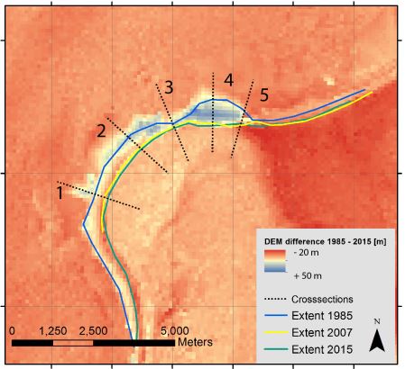
They found interesting results adding to process understanding and long-term fluctuations alike: Between 1954 and 1966 (i) the ice surface has lowered by about 0.5 m/yr, (ii) the ice cliff position has undergone a heterogeneous pattern with areas of advance and retreat and has advanced on average in the order of 0.5 m/yr and (iii) ice motion has reduced to half its initial values. These results are remarkable as they are counterintuitive with a generally negative mass balance and a reduction of ice cliff height vs. a net advance of the cliff.
This intriguing evolvement warrants closer attention as it remained unstudied thereafter even though it is likely relevant for a large portion of cold and dry North Greenland. Using recently published spaceborn digital elevation models from the mid 1980s and the mid 2010s we confirm the persistence of the counterintuitive behaviour of negative surface mass balances and advancing ice cliffs.
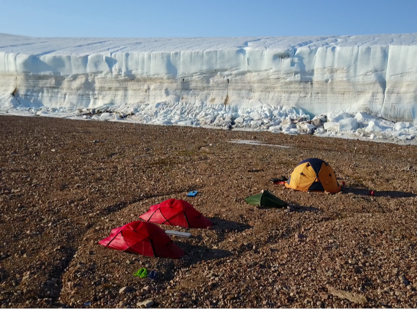
Reconnaissance field trip
During 8th and 22nd of August 2017 we performed a reconnaissance expedition to the Red Rock ice cliffs (76°55' N | 66°58' W). We aimed at meterological, glaciological and hydrological measurments to understand the glacier-climate regime and to prepare for a follow-up grant. Results to follow...
Staff
Jakob Abermann - Asiaq, Greenland
Rainer Prinz - University of Graz, Austria
Jakob Steiner - University of Utrecht, Netherlands
Funding Agency
Government of Greenland - Pulje C, Tips og Lottomidler
Acknowledgements
We are deeply indepted to the ACInn, GEUS and enveo, and all the great and helpful people in Thule (Jens, Rene, John, ...) who facilitated this campaign.
Climate-Glacier Relationship on Mount Kenya
Explaining the glacier retreat ...
|
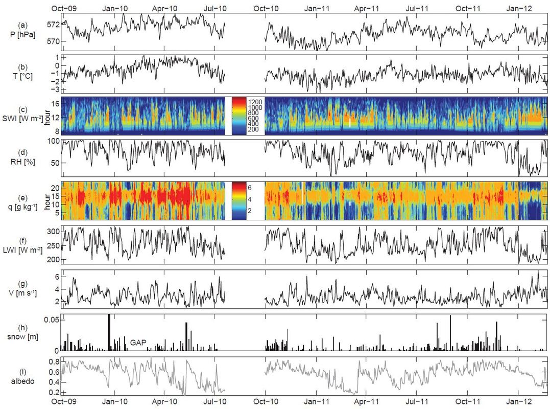
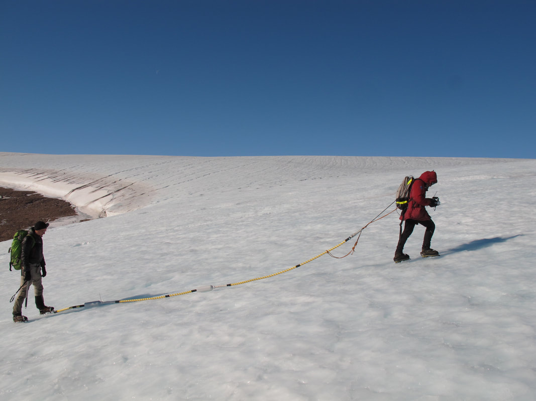
... using high resolution meteorological measurements ...
|
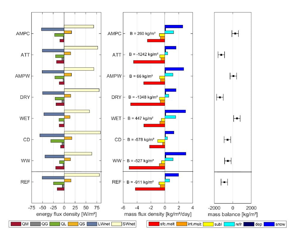
... and process based numerical models.
|
A combined investigation of glacier history and multi-scale climate dynamics on tropical high mountains - from both field measurements and modelling - has the potential for revealing a sophisticated history of climate in the tropical mid-troposphere, where routine meteorological measurements are very rare.
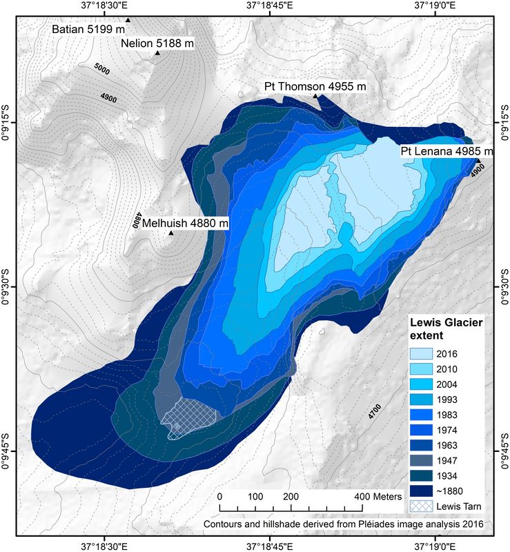
- We found that the retreat of Mt Kenya's glaciers is not a warming signal, it is a drying signal. This means that not enough snow fall accumulates on the glacier and thus the mass input and the surface albedo are reduced. Additionally, reduced cloud cover increases the net solar radiation flux, which enhances the available energy for melting snow or ice.
- This low sensitivity to air temperature and high sensitivity to moisture related climate variables is characteristic for tropical glaciers, e.g. on Mt Kilimanjaro (fact sheet).
- We extended the the time series of glaciological monitoring on Mt. Kenya, making Lewis Glacier among the best studied tropical glaciers world wide.
- Staff & Funding: ACINN | FWF
- News & Updates: Lindsey Nicholson's blog
- Press & Media: Mountain Partnership, GlacierHub, The New York Times Magazine
Hintereisferner -
|
Hintereisferner, Austria, 31.08.2015. (Photo W. Gurgiser, ACINN)
|
hiSNOW
High resolution monitoring and modelling under climate change conditions. Frequent terrestriasl laser-scanning, traditional mass balance monitoring, satellite remote sensing and numerical modelling determine glacier mass balance and runoff at a range of temporal scales. more
|
Hochjochferner, Austria (Photo R. Prinz, 29.08.2013)
|
ALPSAR
The AlpSAR campaign supports preparations for the CoReH2O (Cold Region Hydrology High-Resolution Observatory) satellite which is one of three candidate missions of the Earth Explorer Programme of ESA. A main objective of CoReH2O is to map and monitor the mass (the snow water equivalent) of seasonal snow on land surfaces and of winter snow accumulating on glaciers. more
|
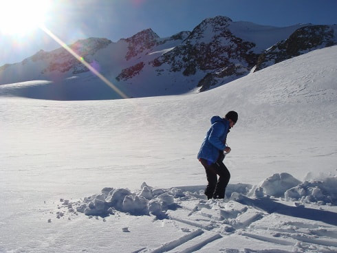
Starting to dig a snow pit on Mittelbergferner, 20 Nov. 2012. (Photo ENVEO)
|
Langenferner
Mass balance monitoring for the Hydrographic Office of the Autonomous Province of Bozen-South Tyrol, Italy
|
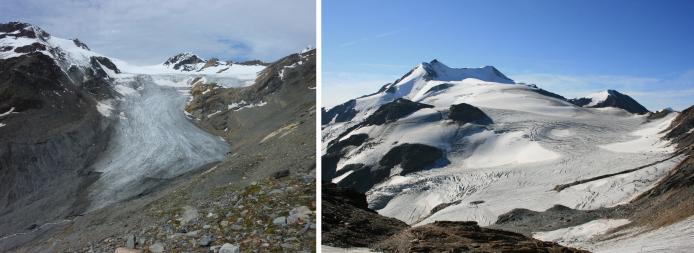
Terminus and upper part of Langenferner (Photo ACINN)
|
(c) 2017 - Rainer Prinz
Header: Lewis Glacier, Kenya, Oct 2012
Header: Lewis Glacier, Kenya, Oct 2012